
In September, DataKind held a three-day virtual DataDive® event in partnership with the International Monetary Fund (IMF). Hundreds of volunteer data scientists dug into data to develop with innovative solutions to some of the complex, intractable issues identified by the IMF. These included a common problem for global advising institutions: missing and inconsistent data on a global scale prevents them from making key decisions on how to mitigate the risks of climate on the built environment. In the case of the IMF, the stakes are high, as these insights will be shared with their 190 member nations and have an influence on policies affecting billions of people.
Climate change is the greatest threat that our world faces in modern society, and will continue to have destabilizing impacts on health, resources, safety, and security. A major concern is the resilience of the built environment, which includes everything from transit infrastructure to housing. This has major implications for individuals and communities locally, and creates challenges for both mitigation and adaptation. However, there’s not enough good data on assets at risk from climate hazards, such as human-made infrastructure, especially buildings. Data describing building details such as height and construction materials is missing, outdated, and inconsistent in different global regions, and due to differences in building types, previous modeling techniques don’t scale globally.
Precise mapping and cataloging of structures worldwide will enable governments, policymakers, civil society, and business to more accurately assess vulnerability to climate-related hazards such as floods, hurricanes, wildfires, and other natural disasters. Geocoded data enables better estimates of potential exposure, determining the proximity of buildings to high-risk areas, and evaluating the structural integrity of each building. This information is crucial for developing accurate risk mitigation strategies.
DataKind’s Approach
“We’re asking you to help us build a global census of structures – houses buildings, factories, roads, bridges – everything that’s part of the built environment,” said Marco Martini, Division Chief of the IMF, when speaking at DataKind’s DataDive event in September. “We know that there are several datasets out there that can help us achieve these very ambitious goals.”
At DataKind’s DataDive event, hundreds of volunteer data scientists from around the world dug into the data, beginning by focusing on data from Bangladesh, Costa Rica, Mozambique, Dominica, the Netherlands, Kenya, and South Africa. They developed classification and risk impact models based on GIS, population, and satellite imagery open datasets. This led to building out the structure for a new, massive geocoded census of structures including key details identified by the IMF, harmonizing data from disparate sources and linking it to supporting datasets in order to build a more accurate and useful picture of climate risk.
“Our goal,” says Martini, “is to make this information available to nations, so that governments and policymakers can assess the risk that these structures face from climate hazards.”
Key Insights
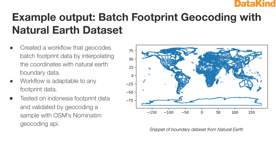
Faster, More Accurate Geocoding
Using the Natural Earth dataset, DataKind expanded the scale and scope of the data analysis. This broader reach ensures a more comprehensive and accurate view when modeling building climate risk.
Improve Building Footprint Data with Height Density
Combining geocoded building footprint data with height data enables better modeling of climate vulnerabilities such as rising sea levels, storm surges, or intensified wind patterns.
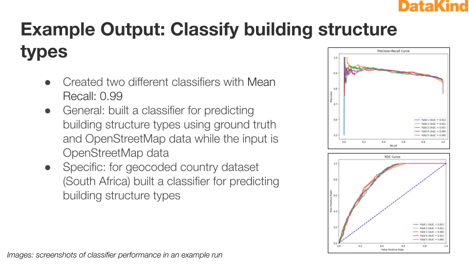
A Classifier to Better Predict Building Types
In order to fill in key data that’s often missing or inaccurate, such as whether a building is residential or commercial, DataKind leveraged ground truth data and OpenStreetMap for more accurate classification. This is particularly important in high risk zones to inform climate mitigation strategies and predict financial repercussions of climate events.
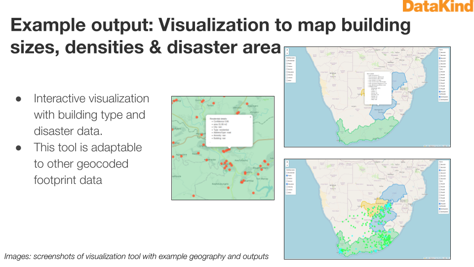
Data Visualizations to Clearly Communicate Layers of Data
Data visualizations enable communication of many layers of complex data, including historical data of climate disasters, administrative regions, and building statistics. When combined with geocoded data, this provides a much clearer picture of climate risk that’s accessible to a much larger audience.
Next Steps
These methods can be implemented immediately by the IMF and partners, and opens up opportunities for both short and long term climate planning. Work is continuing to build on this foundational set of methods to create a global building census as a fundamental resource for managing the financial impact of climate change.
Long term, these resources could offer important contributions to vital policy development. Completed building datasets can create models to forecast climate-induced damage and fit those models into broader work on climate finance frameworks. DataKind is currently working with the IMF to present these findings, and offer new recommendations to key stakeholders and member states in early 2024.
This project is supported by our generous partners, Mastercard Center for Inclusive Growth & Teradata Cares.